


Voting District 150105, Oneida County, New York
About
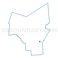
Outline

Summary
| Unique Area Identifier | 632986 |
| Name | Voting District 150105 |
| County | Oneida County |
| State | New York |
| Area (square miles) | 0.94 |
| Land Area (square miles) | 0.94 |
| Water Area (square miles) | 0.00 |
| % of Land Area | 100.00 |
| % of Water Area | 0.00 |
| Latitude of the Internal Point | 43.05979280 |
| Longtitude of the Internal Point | -75.26669230 |
Maps


Graphs
Select a template below for downloading or customizing gragh for Voting District 150105, Oneida County, New York


Neighbors
Neighoring Voting District (by Name) Neighboring Voting District on the Map
- Voting District 150101, Oneida County, NY
- Voting District 150103 150304, Oneida County, NY
- Voting District 150104, Oneida County, NY
- Voting District 150203, Oneida County, NY
- Voting District 150204, Oneida County, NY
- Voting District 150303, Oneida County, NY
- Voting District 220303, Oneida County, NY
Top 10 Neighboring County Subdivision (by Population) Neighboring County Subdivision on the Map
Top 10 Neighboring Place (by Population) Neighboring Place on the Map
Top 10 Neighboring Unified School District (by Population) Neighboring Unified School District on the Map
Top 10 Neighboring State Legislative District Lower Chamber (by Population) Neighboring State Legislative District Lower Chamber on the Map
Top 10 Neighboring State Legislative District Upper Chamber (by Population) Neighboring State Legislative District Upper Chamber on the Map
Top 10 Neighboring 111th Congressional District (by Population) Neighboring 111th Congressional District on the Map
Top 10 Neighboring Census Tract (by Population) Neighboring Census Tract on the Map
- Census Tract 253, Oneida County, NY (7,122)
- Census Tract 254, Oneida County, NY (5,990)
- Census Tract 217.01, Oneida County, NY (3,295)
- Census Tract 251, Oneida County, NY (1,847)